Compass Rose: Most human communities have at least four cardinal points of orientation. Many cultures base their sense of place in the world or worldview on what could be called ‘direction’ such as north, south, east, and west. Others, such as the Karuk of northern California, use points of cultural importance such as the Klamath river to describe ‘where they are in the world’ in relation to that sacred source. Other peoples use specific stars or the winds, not only to guide their travels, but to shape their life path. Maps, in the widest sense, reflect not only how we see the world, but also how we chart our course and thus our direction of travel in that world.
The foundational value of csuglobal as a publication is interdisciplinarity. The compass rose of our logo is therefore intended to offer a perspective to authors (and readers) as well as act as a call to go beyond the ‘cardinal directions’ of our disciplines by recognizing all the half and quarter directions of those points on our collective cognitive chart. We aim to be rooted in place so as to explore California’s rich and global identity in more depth while at the same time creating a space that is aspirational for all our peoples in our respective roles.
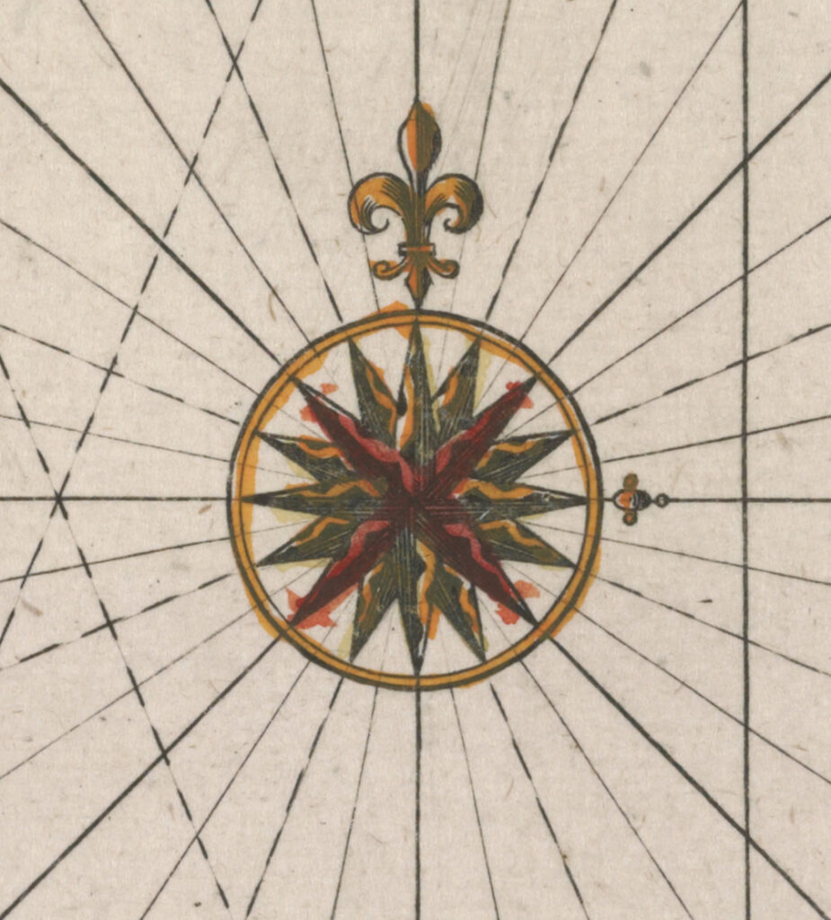
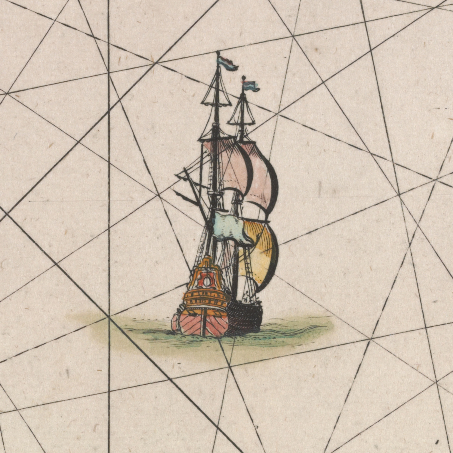
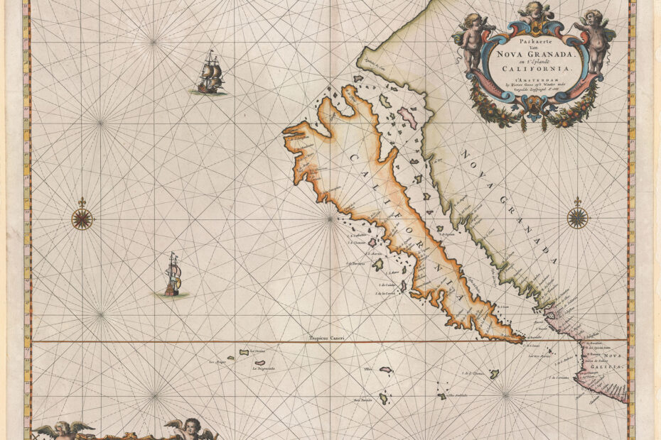
The rose chosen as the inspiration for the csuglobal logo appears on the Paskaerte van Nova Granada, en t’Eylandt California created by Pieeter Goos (ca. 1616-1675) of Amsterdam in 1666. Clearly one of the most striking features of the map, as indicated in the title, is the fact that California is portrayed as an island.
The earliest Spanish maps from the 16th century show California as having a continuous coastline. However, around 1620, Carmelite friar, Antonio de la Ascensíon, accompanied Sebastian Vizcaíno on his West Coast expedition of 1602-03 and is credited with presenting the idea of California as an island. Here, the map entered the realms of piracy, intrigue and fantasy.
Maps, at that time, were generally considered state secrets and Spanish maps were particularly valuable. In this case, it is generally accepted that the Dutch must have captured a Spanish ship and sent the plundered maps to Amsterdam where they were widely copied.
Goos, a renowned Dutch map and chart maker, bought the copperplates of the famous guide book for sailors, De Lichtende Columne ofte Zeespiegel (Amsterdam 1644, 1649, 1650) from Anthonie Jacobsz. Goos then added maps of his own and published editions of the work in a number of languages. In 1666, he published De Zee-Atlas ofte Water-Weereld (where this map of California appeared). Given the fact this collection was considered one of the best sea atlases of the time, it dominated the Dutch market for years.
As a result, Goos’s map – the first sea chart to focus specifically on California – is one of the most sought-after maps of its kind. R.V. Tooley, a widely recognized authority of antiquarian maps, referred to it as “Perhaps the most attractive and certainly the most definite representation of California as an island.”
The map includes many of the present-day place names – if incorrectly placed along the coastline. More relevant is the fact that it uses the name of California for the entire area with its origins in the novel Las Serges des Esplandian by Garci Ordóñez Montalvo, popularized in 1510.
The ‘adventures’ of Esplandian (the son of Amadis, another romantic hero) are widely believed to be based on older stories found in Portuguese and French culture. Whatever the source, the stories tell of Queen Calafia, the ruler of a mythical and wonderful island nation: California. As the leader of a brave Amazonian people “on the right hand of the Indies” and “very close to the side of Terrestrial Paradise”, Calafia became the foundation of many fantasies, fueling political plots, hopes, plans and disasters, and creating the name of what became the state of California in the process.
The logo, like the map’s own history, has undergone some changes. Most compasses traditionally point north. We have intentionally given priority to the west – away from the dominance of the north and towards both the place and ideal of California. Similarly, while the fleur de lis is a traditional cartographic symbol (as well as an ancient heraldic symbol of the French monarchy) we have again chosen to alter its appearance. The change is an attempt to move the image away from its other uses over time, particularly its use as the literal brand burned into the shoulders of slaves who had run away in what was the French territory of Louisiana.
Thus, from the outset and even as we use the tools and images we have to hand, the journal seeks to challenge our traditional understanding of the themes shaping our collective intellectual experience. We believe this map – and with it our revised and updated compass rose – illustrates the global stock and mythical power of the idea that ultimately became the state of California. At the same time, the presentation of California as an island – set apart from the rest of the United States – remains as relevant in contemporary politics, economics and culture as it was when travelers, sailors, conquerors, immigrants and refugees slowly arrived on the western shores of the continent and becoming part of the ongoing story of a global California.
We are grateful to the David Rumsey Map Center at Stanford University for the open access to this map and we hope you will join us on this journey.